
Walk a Mountain View Street Directory Search
A street-by-street search works best as a chain. Start with the physical address. Use the Assessor to learn the APN and the current transfer reference. Use the county map to see the parcel and its neighbors. Move to the Clerk-Recorder for a deed party or document number. Then use permits, reverse directories, or census schedules when the question is about a listed household or an earlier period.
The sequence below keeps modern property evidence separate from occupant evidence. It also avoids claiming that an unverified portal feature can browse a whole street.
- Enter the situs address in the Santa Clara Assessor Real Property Search. Save the APN, transfer reference, values, exemptions, and tax-rate jurisdictions.
- Open the parcel in the County’s Property Explorer or City zoning map to understand lot shape, nearby parcels, and land-use context.
- Take the APN result or document reference to the Clerk-Recorder. Search the acquisition instrument by party, instrument number, or book and page.
- Read the deed’s grantor, grantee, recording date, and legal description. Search the seller as an earlier grantee to move backward.
- For a past occupant, compare Haines or Pacific Bell reverse directories, Polk volumes, newspapers, permits, and census schedules.
The output is a documented address trail. It may identify an owner, a past occupant, a building event, or a map feature. Those are different results, and the Mountain View street directory should say which one was found.
Mountain View Street Directory Fields
The Assessor is the practical first stop in a Mountain View street directory because it accepts the physical address and the APN. The simple mode uses a property-address autocomplete. Advanced mode breaks the address into parts. The APN tab accepts an eight-digit parcel number with or without dashes. All modes require acceptance of the portal terms.
| Property address | Simple address field for the situs or physical property, not a mailing address. |
|---|---|
| Street number | Numbers only; optional in the advanced mode. |
| Street name and type | Street name is required in advanced mode. Type choices include Street, Road, Avenue, Drive, Lane, Way, and others. |
| Direction | Dropdown with North, South, East, and West. |
| Unit | Optional numbers-only field for a unit. |
| City | Required in advanced mode and includes Mountain View among county localities. |
| APN number | Eight digits, with or without dashes, in the 000-00-000 format. |
No owner-name or ZIP field appears. Santa Clara’s public web presentation omits assessee names, so an address hit should be recorded as parcel evidence. The sampled Mountain View result showed a document number and type, transfer and tax-default dates, tax-rate entities, land and improvement values, exemptions, and net assessed value. Owner names and a full mailing address were not visible in that sample.
The Assessor search tabs are visible in the source image linked from the official portal. They explain why a by-address lookup can start the street directory without becoming a name list.
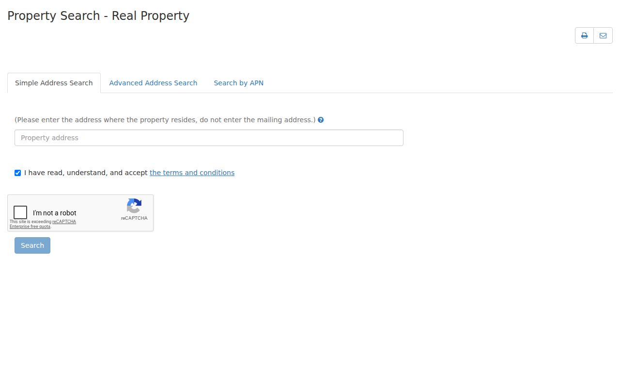
Carry the APN forward, but do not carry an assumption about who occupies the property. A parcel key is durable; a household can change.
Mountain View Records Found by Address
The street directory is a set of address-keyed and address-linked records. Some sources accept an address directly. Others require the APN, a party name, or a document number first.
| Record set | Keeper | What it contributes | Access |
|---|---|---|---|
| Assessment record | Santa Clara Assessor | APN, values, transfer reference, exemptions | Free individual address/APN search |
| Parcel context | County Property Explorer and City zoning | Nearby parcels, layers, zoning context | Free interactive maps |
| Recorded deed or map | Clerk-Recorder | Legal parties, title evidence, legal description | Office workstation or paid copy |
| Permit or address file | Mountain View departments | Construction, use, or official address event | ePermits, counter, or CPRA request |
| Reverse directory | Libraries and research collections | Listed occupant and phone/address clue | In-library or licensed collection |
| Census schedule | National Archives | Historic household and relationships | Free 1950 census portal |
The APN ties the Assessor to parcel context, but it does not search the Recorder. The street name ties an address to a reverse directory, but a renamed street can break a naive query. Every link in the chain needs its own source.
Mountain View Street Directory Map
Santa Clara County’s Property Explorer became the primary property-research map on April 10, 2026, replacing the earlier Interactive Property Assessment and Property Profile tools. Search or select a property, then use the detail side panel and interactive map to explore the selected parcel and layers affecting it. The official launch material does not establish a radius tool, owner link, measurement control, export control, or exact search-label set, so those features should not be promised.
For a whole street, the responsible method is visual and parcel by parcel. Keep the map and side panel open, pan to the next adjoining polygon, record its address or APN, and query that parcel in the Assessor. The City zoning map adds an address-searchable view with Identify, Query, Find, and map export tools. Its zoning display is not a survey or transaction-grade determination.
The County’s Property Explorer launch notice describes a timely change in the Mountain View street directory workflow, but it does not create a public list of occupants.
Use the map to choose the next parcel. Use the Assessor and Recorder to test the parcel’s record trail.
Mountain View Street Directory Deed Limits
Santa Clara County’s public Internet grantor-grantee index was withdrawn on November 5, 2018. The public workstation at the Clerk-Recorder searches 1981 to the present by name, document or instrument number, or book and page. Digital Reel covers recorded documents and maps from 1850 to 1980. An address and APN are not Recorder index keys, and staff do not perform the chain-of-title research for a visitor.
Once the Assessor supplies a current transfer reference, search the acquisition deed. Note the seller, then search that seller as a grantee in an earlier period. Pre-1994 work commonly uses book and page. The deed may show parties, a legal description, a date, and document identifiers. It does not show every occupant, roommate, household member, or visitor.
Copy orders can be placed at office kiosks, by email to bus-rdc@rec.sccgov.org for a paper copy, or by mail to the Business Division. The County lists $4 for the first page, $2 for each later page, and $2 for certification per document, with channel-specific card charges. The office estimates up to seven business days. The copy instructions show why a street directory user may need a counter visit rather than a web search.
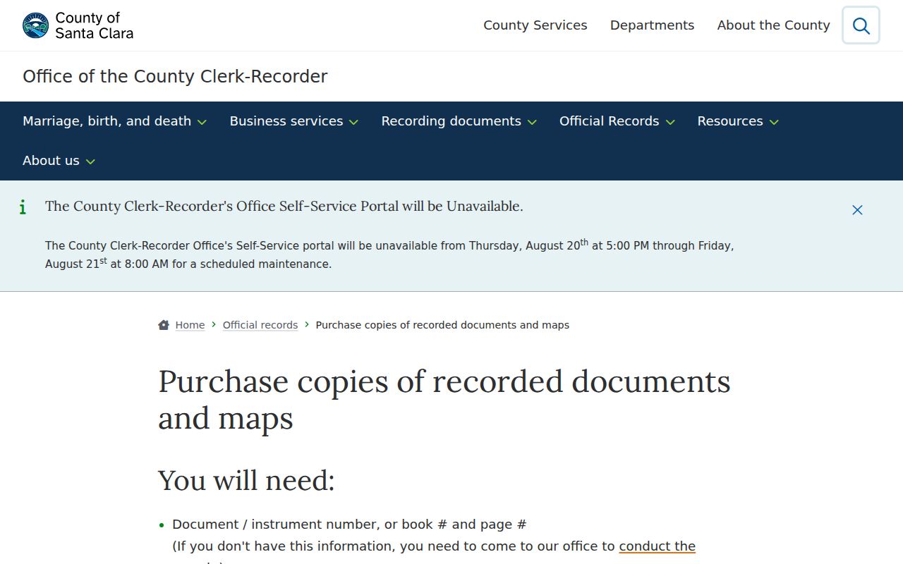
The image documents an access channel, not an owner result. A source’s retrieval process is part of the record trail.
Mountain View Street Directory Permits
Mountain View Community Development keeps planning, building, zoning, and development material at City Hall. ePermitsMV is the current application system. Its location step asks for number, direction, street, type, apartment, the relationship to the property, and building type. The current guide says applications are handled exclusively through ePermitsMV. No official anonymous issued-permit history search by address was located, so an account, counter question, or focused CPRA request is the honest fallback.
The City Addressing System is more specific when an old address no longer matches a present search. An owner submits each affected APN and a site plan through ePermitsMV. The City notifies AT&T, PG&E, USPS, the County Assessor, emergency dispatch, and City departments, then creates a permanent address file. The research lists a $288 fee for an ADU, single-family, or duplex request and $451 for multifamily or nonresidential work, with stated three-week processing.
The ePermits location fields appear in the linked Mountain View application system. They are useful for understanding how an address is entered, not for assuming that an old permit archive is browseable.
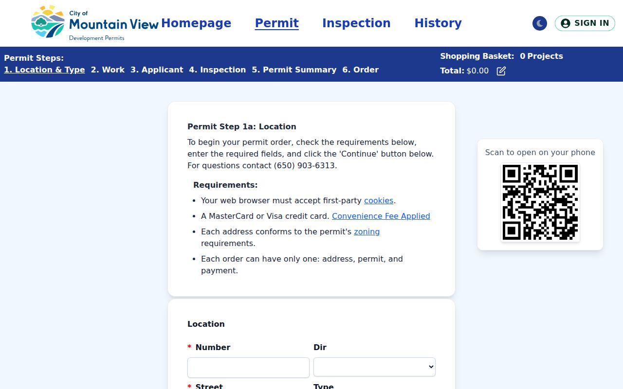
An address-change file can bridge a historic street label to its current form. It can also identify a project applicant, which is evidence of project involvement rather than proof of residence.
Mountain View Street Directory Name Changes
Older Mountain View street directory searches can fail because the street name changed. Pastoria Avenue became Rengstorff Avenue in 1929. Search both names when a deed, map, newspaper, or directory falls on opposite sides of that change. The City’s historical context and the Public Works block book can help bridge the name, paving, and address history.
Moffett Boulevard was paved in 1933 and marketed as a gateway to Moffett Airfield. That kind of local change matters because a directory may use a street label that a modern map no longer displays in the same way. Do not treat a zero result as proof that a parcel or household did not exist. Test the former name, a nearby cross street, the map book, and the legal description.
County Map Books index roughly 5,900 recorded maps from about 1850 through 1957 in 108 volumes. Archives has explicit volume gaps, so a missing Archives sequence should trigger a Recorder check rather than a conclusion that no map exists. The County Map Books index preserves the land-history lead.
Map indexes preserve the land’s shape and subdivision history. They do not substitute for a deed or a household record.
Mountain View Street Directory Terms
Address research gets clearer when the core terms stay distinct. A situs is the physical location. A mailing address routes notices and may be elsewhere. A legal description identifies the land by lot, tract, survey, or metes and bounds. An APN is the Assessor’s parcel identifier.
- Situs address
- The physical property address used by the Assessor’s search.
- Mailing address
- The destination for notices. It can be a post-office box or another property.
- Parcel
- A defined unit of land tracked by an APN and legal description.
- Plat or map
- A recorded drawing that can connect streets, lots, blocks, and subdivisions.
- Criss-cross directory
- A reverse directory arranged by street and number, often showing a listed occupant or phone clue.
A homeowner exemption can support an owner-occupancy inference, but it does not list every person at the address. Other household members are generally absent from property and deed sources. The term “neighbor” likewise means nearby parcel evidence unless an occupant-oriented source says more.
Mountain View Street Directory Privacy Limits
No public Mountain View street directory supplies a complete list of current occupants. DMV and utility-customer addresses are not substitutes. A deed shows legal parties. A permit can show an applicant or owner. A reverse directory shows a listed person in a particular year. A voter source is purpose-limited. Even a strong address match should be treated as a lead until the custodian or a second source supports the fact.
Privacy limit. Address records are for lawful personal research, family history, civic understanding, and property questions. Do not use a street directory to stalk, harass, intimidate, or harm another person.
When the goal changes from a whole street to one person, a Mountain View resident lookup can compare the name, case, vital, license, and historical trails. When the goal is a house’s past, the deed chain and directory years belong on the prior-resident path. Keeping those angles separate makes the address search more precise.